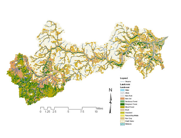
From its origin, Lapwai Creek flows 5.5 miles before discharging into Winchester Lake near Winchester, ID and from there flows in a Northerly direction for approximately 25 miles where it enters the Clearwater River near Spalding, Idaho. Lapwai Creek, a fourth-order stream, is located within Nez Perce and Lewis counties in North-Central Idaho. The Lapwai Creek watershed drains approximately 174,600 acres and is comprised of several tributaries, including Sweetwater Creek, Webb Creek, Mission Creek, Tom Beall Creek, Spring Creek, and Garden Gulch Creek. It is composed of upland plateau and steep canyon habitat ranging from elevations of 785 feet at the mouth to 3,917 feet at the outflow of Winchester Lake (GoogleEarth). Precipitation varies based on elevation, with annual average total precipitation of 24.1 inches in the upland portions and 12.7 inches near the mouth. Lapwai Creek passes through several small communities including Culdesac, Sweetwater, Lapwai and Spalding, and is bordered by highway 95 for the majority of its course. This, along with railroad activity has resulted in stream channelization and bank instability (Nez Perce Soil and Water Conservation District (NPSWCD)).
The Lapwai Creek watershed is located mostly within the boundary of the Nez Perce 1863 Reservation. However, most of the land is privately owned (86%) with small allotments being Tribal (13%) or State (1%) owned (NPSWCD). The dominant land use in the watershed is agriculture (70%), with areas of coniferous forest lands (30%) (Integrated Basin Analysis).
The watershed contains A-run steelhead, resident rainbow trout, fall-run chinook salmon, coho salmon, paiute sculpin, mottled sculpin, torrent sculpin, speckled dace, longnose dace, bridgelip sucker, chiselmouth, northern pike minnow, redside shiner, and smallmouth bass (NPSWCD). In the early 1990’s, the salmon and steelhead species were listed as either “Threatened” or “Endangered” under the Endangered Species Act, and in 2000, Lapwai Creek and its tributaries (specifically Webb Creek and Sweetwater Creek) were federally designated as “critical habitat” for steelhead spawning (Higgins et al. 2011).
Early studies indicate that water quality in Lapwai Creek is limited by extreme annual stream flow variation, low summer flows, high summer water temperatures, and lack of instream cover (Fuller 1985). In 1999, Lapwai Creek was listed on the State of Idaho’s 303(d) list for bacteria, dissolved oxygen (DO), flow alteration, habitat alteration, nutrients, organics, sediments, and temperature.
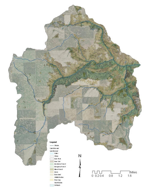
Photos taken in October, 2016, left, and March, 2017, right, show the variation in stream flow throughout the year (near the mouth of Lapwai Creek).
Lapwai Creek Watershed Ecological Restoration Strategy (2009)
Nez Perce Tribe
Lapwai Creek Roadside Weed Inventory Summary Report (2007)
Nez Perce Soil and Water Conservation District
Lapwai Creek Roadside Weed Inventory Summary Report (2006)
Nez Perce Soil and Water Conservation District
Physical Characterization of Riparian Area – Lower Lapwai Creek (2002)
Idaho Soil Conservation Commision
Lapwai Creek Aquatic Assessment (2001)
Center of Environmental Education at WSU
Lapwai Creek Supplemental Watershed Protection Plan-Environmental Assessment (2000)
Winchester Lake and Upper Lapwai Creek TMDL Implementation Plan (2000)
Idaho Department of Environmental Quality
Winchester Lake and Upper Lapwai Creek TMDL (1999)
Idaho Department of Environmental Quality
Lapwai/Mission Creek Water Quality Status Report (1986)
Department of Health and Welfare
Winchester Lake Water Quality Status Report (1985)
Department of Health and Welfare
Lapwai Creek Study (1980)
Department of Health and Welfare
Lapwai Creek Preliminary Investigation (1980)
Lewis Soil Conservation District
The Cottonwood Creek subbasin, 5th field hydrologic unit code (HUC) # 1706030513 drains approximately 124,439 acres in Idaho County Idaho. Cottonwood Creek is a fourth order tributary to the South Fork Clearwater River. It originates in the steep, forested lands of Cottonwood Butte and flows eastward across the rolling cropland of the Camas Prairie and into the deep canyons found in the eastern portion of the watershed, where it then enters the South Fork Clearwater River near Stites, Idaho. Cottonwood Creek flows from an elevation of 5,730 feet to an elevation of 1,332 feet. Land uses consist of cropland (74%), pastureland (7%), rangeland (13%), forestland (6%), and urban areas . The City of Cottonwood and a small portion of the City of Grangeville are found within the watershed. There are five major tributaries of Cottonwood Creek: Stockney Creek, Shebang Creek, Red Rock Creek, Long Haul Creek and South Fork Cottonwood Creek. Cottonwood Creek and its five tributaries are all listed in the Integrated §303(d)/ §305(b) Report as water quality limited from their headwaters to their mouths. Red Rock Creek is located on the Nez Perce Indian Reservation and is currently being monitored on a quarterly basis by the Nez Perce Tribe, along with 2 sites on the mainstem of Cottonwood Creek. Waterfalls that have been identified as fish barriers are found on Cottonwood Creek and Red Rock Creek at 3.6 miles and nine miles, respectively.
Climate in the Cottonwood Creek basin is characterized by cool, moist winters and warm dry summers. Air temperatures in the basin typically decrease as elevation increases. Average annual precipitation ranges from 20-25 inches across most of the basin with over 30 inches falling in the Cottonwood Butte area Monthly precipitation averages are greatest from March to June and the least during July, ranging from 2-3 inches a month in the spring to 1-2 inches per month during the rest of the year. Total precipitation in 2001 and 2005, the two IASCD sampling periods, were very similar, coming in at 19.95 and 19.42 inches, respectively. Parts of the Cottonwood Creek basin are intermittently covered with snowpack from November – March.Average annual snowfall ranges from 22 inches per year in Kooskia to 60 inches per year across the Camas Prairie. Rain accompanied by warm Chinook winds is a common occurrence in the winter and early spring and often results in high intensity runoff events. These high flow events account for the majority of Cottonwood Creek’s streamflow. During the winter, an intermittent snowpack may cover parts of the basin from November – March, providing additional runoff during rain events.
Lawyer Creek Watershed (137,360 acres) is located in Lewis and Idaho Counties. Lawyer Creek is a 4th order tributary, flowing approximately 40.5 miles in an easterly direction to its confluence with the Clearwater River at the town of Kamiah. The lower 35.8 miles are within the Nez Perce Reservation. Elevations range from 1,180 feet at the mouth to 4,480 feet in the uplands. The main tributaries to Lawyer Creek include Willow Creek in the headwaters and Sevenmile Creek in the lower watershed. Talmaks Reservoir, which is about 4 acres, impounds the headwaters of North Fork Willow Creek, which flows five to six months of the year. The BIA created the reservoir in 1964 to increase fishing and recreation opportunities for Tribal members. The towns of Craigmont, Ferdinand, and Kamiah are located in the Lawyer Creek watershed.
Lawyer Creek flows through wet meadows in the upper watershed, courses through a U-shaped canyon for most of its length, and then broadens out for the final 7.7 miles through meadow/pastureland. The lower reach through the City of Kamiah has been channelized and the banks were rip-rapped to reduce flooding potential through the city. The dominant land use in the watershed is agriculture (57 %), with areas of meadow/pastureland (21%), and coniferous forest (15 %). Lawyer Creek supports steelhead/rainbow trout, speckled dace, piute sculpin, Northern pike minnow, chiselmouth, and bridgelip sucker. Fall and spring/summer Chinook salmon also use the lower portion of Lawyer Creek for juvenile rearing, although high summer water temperatures likely preclude this use during warm summer months (BLM 2000).
Sevenmile Creek is approximately 4.6 miles long and discharges into Lawyer Creek at stream mile 3.9. The creek parallels Highway 162 for much of its length. The watershed (11,690 acres) is composed of 95 % cropland, and 4 % meadow/pastureland. Sevenmile Creek contains steelhead/rainbow, bridgelip sucker, and very abundant speckled dace and piute sculpin.
Willow Creek flows mainly through meadow/pasturelands for approximately 3 miles, crossing the southern boundary of the Nez Perce Reservation several times before discharging into Lawyer Creek. The watershed (14,910 acres) is predominantly agricultural (91 % cropland), with areas of meadow/pasture (6 %) and coniferous forest (3 %). Fish species in Willow Creek include steelhead/rainbow, and speckled dace.

Department of Health and Welfare Division of Environment Statehouse Boise, Idaho 83720
Fivemile Creek Watershed (7,945 acres) is located in Lewis County, and entirely within the Nez Perce Reservation. The creek flows in an easterly direction approximately 5.5 miles to its confluence with the Clearwater River, 2.5 miles upriver from the town of Greer. Elevations range from 1,145 feet at the confluence with the Clearwater River to 3,287 feet in the uplands. The stream flows primarily through a steep canyon area, and has several smaller intermittent tributaries. The stream gradient is generally steep and large boulders are common. The dominant land use in the watershed is agriculture (99% cropland). Fivemile Creek watershed supports steelhead/rainbow trout (Kucera 1983).
Early studies have shown that Fivemile Creek water quality is impacted by sparse riparian vegetation, variable annual flows, and low summer flows (Kucera 1983). Nonpoint sources of pollutants are predominantly agricultural activities.

No Reports available at this time
Sixmile Creek Watershed (15,805 acres) is located in Lewis County and entirely within the Nez Perce Reservation. The stream flows in an easterly direction approximately 8.15 miles to its confluence with the Clearwater River approximately 6 miles downstream from the town of Kamiah. Elevations range from 1,119 feet at the mouth to 3,330 feet in the uplands. Effie Creek, the only major tributary, flows into the mainstem about 0.5 mile from the mouth. The dominant land use in Six Mile Creek watershed is agriculture (99% cropland).
The watershed contains steelhead/rainbow trout, speckled dace, and piute sculpin. Densities of young of the year steelhead/rainbow at stream mile 3.9 ranked second among Reservation streams sampled by Kucera (1984), indicating substantial natural reproduction.
Sparse riparian vegetation, variable annual flows, low summer flows, siltation, and high in stream summer temperatures were identified in early studies as impacting the water quality (Kucera 1983, and Fuller 1985). Recent Sixmile Creek stream survey data (NPT 2005) for one reach–188 meters– indicate suboptimal conditions for: width/depth ratios, stream bank stability, cobble embeddedness, large woody debris, and pool frequency.
Roads and logging activities were identified as contributing to the siltation problems (Kucera 1983, and Fuller 1985). Agriculture is also a source of nonpoint pollution in the watershed.

No Reports available at this time