The Tribe’s CWA Section 106 Water Quality Monitoring Program’s primary goal is to conduct water quality investigations. These investigations will help to inform the Tribe about the ecological health of its water resources, assist in determining appropriate management strategies for those waters, identify the causes and sources of pollution, and advance efforts to protect both human and aquatic health” (Nez Perce Tribe Water Resources Monitoring Strategy, 2023).
The WRD applied for and received Treatment in the Same Manner as a State (TAS) to implement the Clean Water Act 106 Water Quality Monitoring Program in 1990. In 1999, the WRD began collecting water quality data for Reservation water bodies.
Data was collected at 35 sites during this first year. Water Quality data has been used to determine the overall health and condition of the Tribe’s surface waters.
There are over 1,590 miles of perennial streams on the Reservation and 2,883 acres of ponds and reservoirs. Of the Reservation stream miles, approximately 980 miles have been assessed for water quality. Over 680 of the assessed stream miles are considered impaired.
The larger reservoirs, including Mud Springs Reservoir, Talmaks Reservoir, and Winchester Lake are also impaired for water quality. The WRD continues to assess Reservation waterbodies to target areas for restoration, track long-term trends in water quality, determine the effectiveness of best management practices, and gather information on waterbodies that have not been assessed.
The WRD also collects water quality data for groundwater and springs. Water quality data has been collected on over 15 wells throughout the Lapwai Valley and Kamiah area. Since 2006, 32 springs have been monitored. This data will provide valuable information on the overall quality of our drinking water and potential contaminant sources.
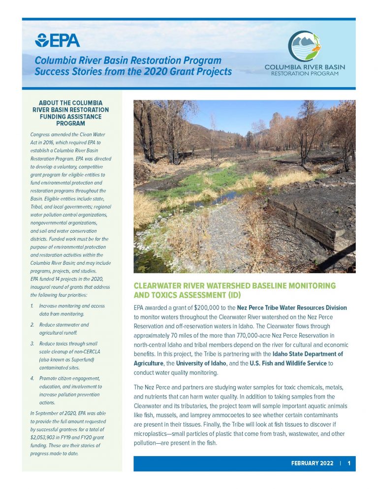
In 2017, the WRD 106 staff collected water quality data from eighteen different monitoring locations in the Lower Lapwai Creek watershed. The majority of Lower Lapwai Creek and its tributaries lie within the Nez Perce Reservation boundaries, and encompass approximately 167,000 acres. Elevations range from 785 feet at its confluence with the Clearwater River near the town of Spalding to 3,917 feet at the outflow of Winchester Lake.
Water Quality Report Coming Soon…
In 2016, the WRD 106 staff collected water quality data from twelve different monitoring locations in the Fivemile Creek and Sixmile Creek watersheds. Both creeks and their tributaries are located entirely within the Nez Perce Reservation boundaries. The Fivemile Creek watershed encompasses approximately 7,985 acres, and elevations range from 1,000 feet at its confluence with the Clearwater River near the town of Greer to 3,500 feet near the headwaters. The Sixmile Creek watershed encompasses approximately 16,067 acres, and elevations range from 1,119 feet at its confluence with the Clearwater River near the City of Kamiah to 3,330 feet near the headwaters.
The Fivemile and Sixmile Creeks Water Quality Report is currently being drafted.
In 2015, the WRD 106 staff collected water quality data from eight different locations in the Cottonwood Creek watershed. The watershed lies entirely within the Nez Perce Reservation boundaries and encompasses approximately 42,700 acres. Elevation ranges from 853 feet at its confluence with the Clearwater River near the town of Myrtle, ID to 3,642 feet in the upland plateaus.
Report: Cottonwood Creek and Tributaries Water Quality Monitoring Report, 2015
In 2014, the WRD 106 staff collected water quality data from six different streams in the Lawyer Creek watershed. The total sum of stream miles located upstream of the monitoring stations within Reservation boundaries is approximately 260 miles, or sixteen percent of the 1,590 total stream miles located within the Reservation.
Report: Lawyer Creek and Tributaries Water Quality Monitoring Report, 2014
In 2012, the WRD 106 staff collected water quality data from eight different creeks in the Cottonwood Creek, Butcher Creek, and Threemile Creek watersheds. Each monitoring site was established at or near the mouth of the respective creek. The total sum of stream miles located upstream of the monitoring stations is approximately 95 miles, or six percent of the 1,590 total stream miles located within the Reservation. This monitoring program was initiated to evaluate water quality in the Cottonwood Creek, Threemile Creek, and Butcher Creek watersheds.
Report: Cottonwood Creek, Butcher Creek, and Threemile Creek Water Quality Monitoring Report 2011-2012
The WRD 106 staff collected water quality data from ten previously unassessed tributaries to the lower Clearwater River from October 2010 through September 2011. Each monitoring site was established at or near the mouth of the respective creek. The total sum of stream miles located upstream of the monitoring stations is approximately 79 miles, or five percent of the 1,590 total stream miles located within the Reservation. This monitoring project was initiated to fill data gaps and to collect baseline water quality data, in order to determine if water quality criteria are being met and if beneficial uses are being supported in these waterbodies. Additionally, the Rock Creek (06601A) monitoring site was established approximately 3.5 miles below a wetland/stream restoration project that will be completed in the fall of 2013. This site will help to determine the effectiveness of the restoration project in improving water quality and hydrology in the Rock Creek subwatershed.
Report: Lower Clearwater River Tributaries Water Quality Monitoring Report 2010-2011
Water Quality Standards are the foundation of the water quality-based pollution control program mandates by the Clean Water Act. Water Quality Standards define the goals for a waterbody by designating uses, setting criteria to protect those uses, and establishing provisions such as anti-degradation policies to protect waterbodies from pollutants.
The Nez Perce Tribal water quality standards are currently under development.
The United States Geological Survey (USGS) has collected water-resources data at approximately 1.5 million sites in all 50 States, the District of Columbia, Puerto Rico, the Virgin Islands, Guam, American Samoa and the Commonwealth of the Northern Mariana Islands.
The following links will direct you to real-time surface-water data, such as gage height (stage) and streamflow (discharge), in the Clearwater River Basin, Idaho.
| 13336500 | SELWAY RIVER NR LOWELL ID |
| 13337000 | LOCHSA RIVER NR LOWELL ID |
| 13337500 | SF CLEARWATER RIVER NR ELK CITY ID |
| 13338500 | SF CLEARWATER RIVER AT STITES ID |
| 13340000 | CLEARWATER RIVER AT OROFINO ID |
| 13340600 | NF CLEARWATER RIVER NR CANYON RANGER STATION ID |
| 13341000 | NF CLEARWATER RIVER AT AHSAHKA ID |
| 13341050 | CLEARWATER RIVER NR PECK ID |
| 13341050 | POTLATCH RIVER BEL LITTLE POTLATCH CR NR SPALDING |
| 13341050 | WEBB CREEK NEAR SWEETWATER ID |
| 13341050 | SWEETWATER CREEK AT MOUTH AT SWEETWATER ID |
| 13342450 | LAPWAI CREEK NR LAPWAI ID |
| 13342500 | CLEARWATER RIVER AT SPALDING ID |
| 13343000 | CLEARWATER RIVER NR LEWISTON ID |
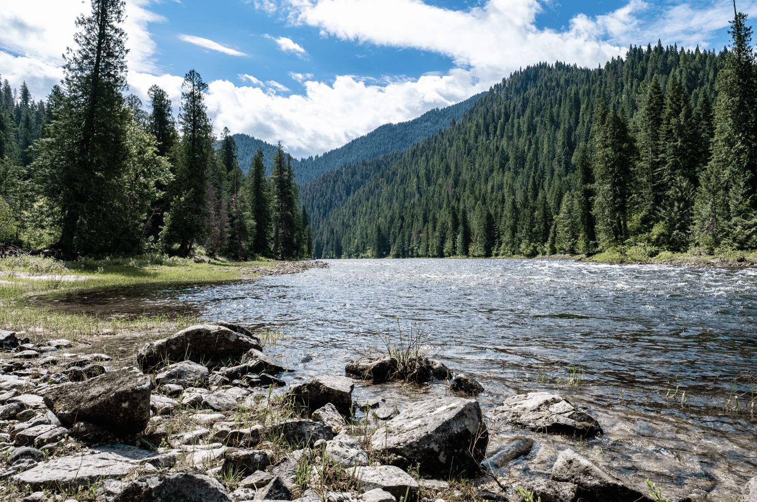
The mighty Columbia River Basin is the fourth largest watershed in North America, and the mainstem of the Columbia is nearly 1,200 miles long. The Basin includes parts of seven U.S. states, as well as British Columbia, Canada. The Snake River Basin, which includes the Clearwater River, makes up the headwaters of the Columbia River.
The Columbia River Basin Toxins Reduction Working Group assembled in 2005 to address the growing concern over toxins in the Columbia River Estuary and River system.The group consists of the Environmental Protection Agency, Tribes, states, non-profit groups, and other federal agencies. The purpose of the group is to disseminate information, coordination activities, and develop strategies to identify and reduce toxins.
The State of the River Report documents the baseline of the water quality in the Columbia River, the need for reducing toxins, and the programs underway in the basin to reduce contamination.
The Water Resources Division has been working to reduce contamination by hosting community cleanups and recycling events where the public can drop off household cleaners, electronics, appliances, and general waste. By collecting and either recycling or properly disposing of these materials, the WRD is keeping mercury, PCBs, and other harmful toxins out of the environment. For more information, go to the WRD’s Solid Waste Management page (link).
The Columbia River Basin and Estuary are considered one of America’s Great Waters. The bill H.R. 4652 is a bill that authorizes funding for protecting the Columbia River, particularly by addressing pollutants in the river and habitat restoration.
This bill will make the Columbia River Protection the main focus of the EPA Northwest Regional administrator, provide more funding to the entire basin rather than focusing solely on the estuary, and make the EPA’s Columbia River Basin Toxics Reduction Plan the overarching plan that will govern restoration efforts.
The Columbia River is a major economic driver in the northwest region. There are 14 hydropower dams on the mainstem of the river, which provides 75% of the power for the Pacific Northwest. Much of the farmland in Idaho, Oregon, and Washington is irrigated using water from the Columbia River and tributaries. The River is used as primary transportation source for large commodities such as wheat, timber, and automobiles. Recreation on the river and tributaries provides a major source of income for many of the communities along these waterways.
Since the late 1800’s, over half of the wetlands in the estuary have been lost. Thirteen fish species, including various species of salmon, have been listed as threatened or endangered under the Endangered Species Act. Historically, 450,000 to 550,000 Chinook salmon returned to the basin each year. In 1999, only 25,000 Chinook salmon returned.
Toxins are present in the water column and in the sediments throughout the mainstem of the Columbia River. In Idaho, over 61 % of the assessed waters are impaired, as well as 99 % of the lakes. These numbers are similar to Oregon’s and Washington’s water quality.
Although efforts have been underway to improve water quality in the Basin, a comprehensive management directive has not been developed to coordinate and track these efforts or to provide funding for research and restoration in areas beyond the estuary, such as the Snake River.
Since the Columbia River Basin is the fourth largest basin in the nation, this task is a large and expensive undertaking. Bill H.R. 4652 will authorize the resources necessary to begin the work needed to help protect these great waters.